On this page
M6.6 Earthquake Strikes NNE of Teluknaga, Indonesia
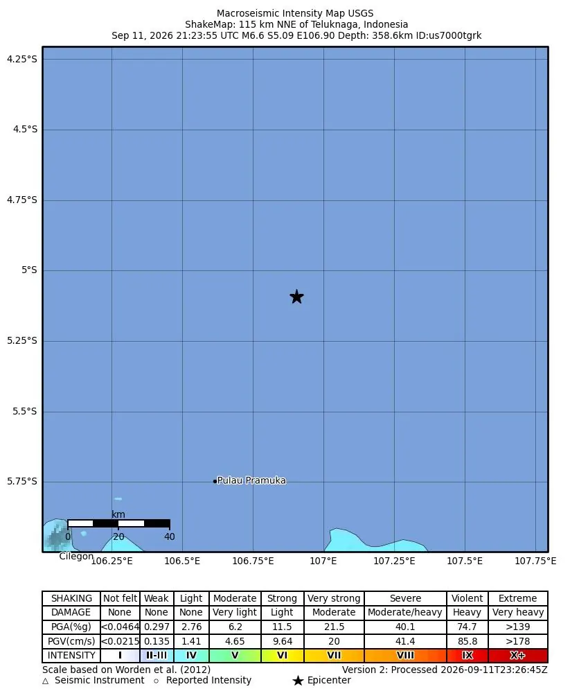
A powerful M6.6 earthquake struck 115 km north-northeast of Teluknaga, Indonesia, on September 11, 2026, at a depth of 358.6 kilometers.
What Happened
A significant earthquake with a moment magnitude of 6.6, designated Mww, occurred 115 km north-northeast of Teluknaga, Indonesia, on September 11, 2026.
The seismic event was recorded at 21:23 UTC, originating from a considerable depth of 358.6 kilometers. The United States Geological Survey, USGS, assigned the event ID us7000tgrk.
Impact and Felt Reports
Despite its magnitude, the extreme depth of this earthquake likely mitigated its surface impact, leading to a green alert level from the USGS.
The earthquake generated a peak Community Internet Intensity, CDI, of 3.4 and a Modified Mercalli Intensity, MMI, of 3.56. According to reports, the tremor was felt by 6 individuals.
For more details on how earthquakes are measured, visit our page explaining magnitude versus intensity.
Tsunami Information
No tsunami warning was issued by authorities following the M6.6 earthquake near Teluknaga, Indonesia.
Due to its deep hypocenter, this earthquake was not expected to generate a destructive tsunami. You can learn more about this phenomenon on our earthquake tsunami guide.
Aftershock Activity
Deep earthquakes, such as this M6.6 event, generally produce fewer and less intense aftershocks compared to shallow earthquakes, though aftershocks can still occur.
Residents are always advised to remain vigilant and follow local safety guidelines. Information on how to behave during an earthquake can be found in our guides section.
Tectonic Setting of Indonesia
Indonesia is situated in a highly seismically active zone, lying within the Pacific Ring of Fire.
This region is characterized by the convergence of several major tectonic plates, including the Eurasian, Pacific, and Indo-Australian plates, which leads to frequent earthquake activity and volcanism. This particular event's great depth suggests it occurred within one of the subducting slabs.
Earthquake Safety Information
While this earthquake had a green alert level, it serves as a reminder for all residents in earthquake-prone areas to be prepared.
Having an earthquake survival kit and a family preparedness plan is crucial.
For comprehensive advice on how to stay safe, explore our dedicated earthquake safety resources. Further technical details about this earthquake can be found on the USGS event page.
Related Reading
Real-time Earthquake Map
View the latest earthquakes worldwide on our interactive map.
Earthquake Preparedness Guide
Essential steps to prepare yourself and your family for an earthquake.
How Earthquakes Happen
Understand the geological processes that lead to seismic events.
Earthquake Notifications
Sign up for alerts about earthquakes in your area.
Earthquakes in Japan
Explore the seismic activity and preparedness in Japan.
FAQ
Frequently Asked Questions
Where did the M6.6 earthquake occur?
The earthquake occurred 115 km north-northeast of Teluknaga, Indonesia.
What was the magnitude of the earthquake?
The earthquake had a moment magnitude of 6.6.
When did the earthquake happen?
The earthquake took place on September 11, 2026, at 21:23 UTC.
Was there a tsunami warning issued?
No, a tsunami warning was not issued for this earthquake, as it was not expected to generate one due to its deep focal depth.
How deep was the earthquake?
The earthquake had a depth of 358.6 kilometers.
How many people felt the earthquake?
Reports indicate that the earthquake was felt by 6 individuals.
Stay Informed and Prepared
Receive timely earthquake notifications and access vital safety resources to protect yourself and your loved ones.